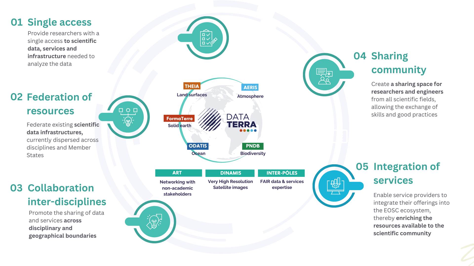
Data Terra consists of five main data and service hubs (or poles), each dedicated to a specific compartment of the Earth system:
-
AERIS (Atmosphere): This hub focuses on atmospheric data, collecting, validating, and harmonizing data from field surveys, long-term observation sites, and satellites. It coordinates multiple data centers and laboratories that provide atmospheric data for research and commercial use.
-
FormaTerre (Solid Earth): Dedicated to solid Earth observation including geophysics and seismicity, this hub fosters the development of products and services that add value to satellite and in-situ data for solid Earth sciences.
-
ODATIS (Ocean): This ocean-specific hub provides data, software, and services for marine science research, covering all oceanic components such as circulation, physical and chemical properties, biogeochemical cycles, ecosystems, and coastal dynamics. It supports researchers through data warehouses, visualization tools, and virtual research environments.
-
THEIA (Land Surfaces): This hub handles land surfaces observation and monitoring, including ecosystem and environmental data at the national level.
-
PNDB (Biodiversity): Focuses on biodiversity data, both marine and terrestrial. It collects and manages observation, collection, and experimental data for biodiversity research and conservation.