New ODATIS coastal flooding product
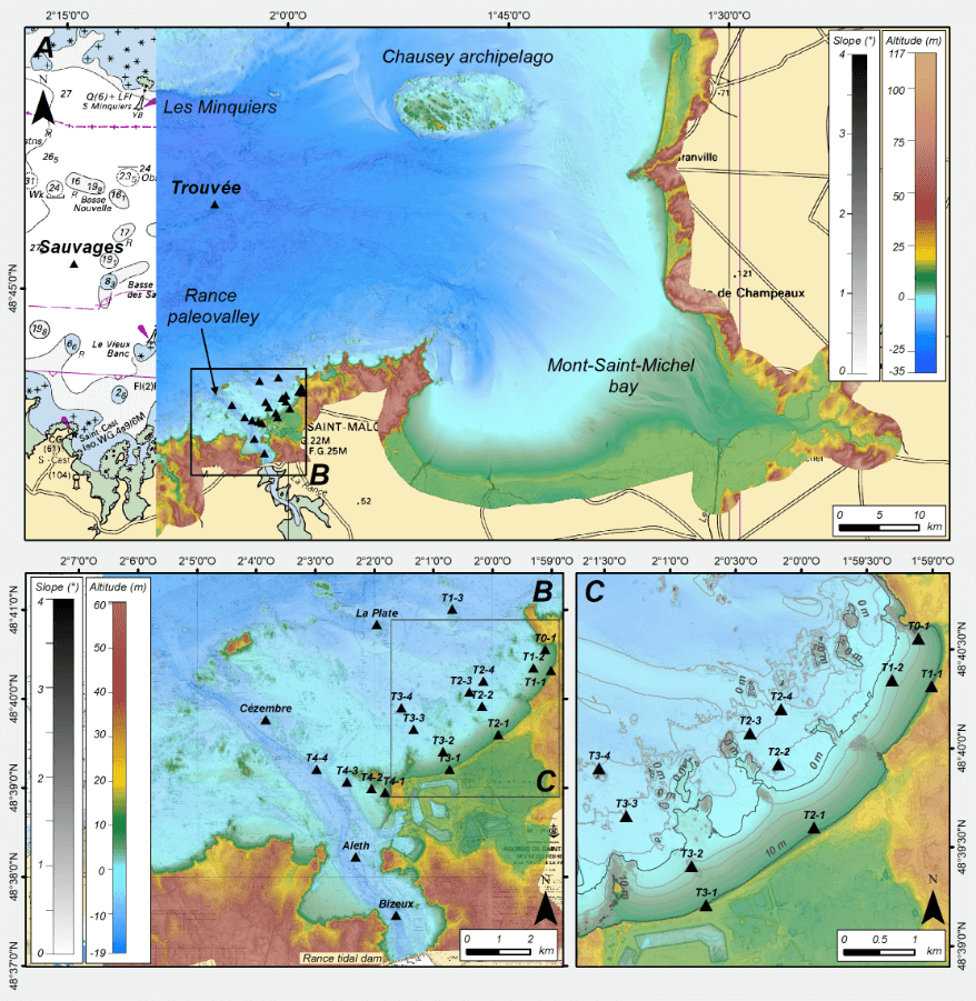
The ODATIS data and services hub has added a new product from the in-situ DSC at SHOM to its catalogue. The product includes datasets from a survey campaign conducted in 2018-2019 in the Bay of Saint-Malo for a flood prevention project.
During the winter of 2018-2019, an oceanographic survey campaign was carried out in the Bay of Saint-Malo by SHOM, the French naval hydrographic and oceanographic office, alongside a bathymetric survey to inform Saint-Malo’s flood prevention action plans. The goal was to assess the Brittany coast’s vulnerability to flood risks, notably by establishing a clearer picture of extreme weather and marine events that can lead to flooding.
With a view to applying FAIR* data stewardship principles, SHOM’s in-situ data and services centre (DSC) created a DOI for this dataset to enable precise and reliable citations in the future. The Sextant marine and coastal geographic data infrastructure hosts these data, which can be downloaded directly from the metadata page.
* Findable, Accessible, Interoperable, Reusable
 Locations of the measurement stations in the Bay of Saint-Malo during the Shom campaign that produced this dataset.
➡️ Discover the sea survey data sets
➡️ More information on the CDS-IS-Shom website


