Space serving research into sargassum seaweed
The Data Terra research infrastructure, through its AERIS (atmosphere) and ODATIS (ocean) data hubs with the participation of DINAMIS (High Resolution imagery), is working to refine a system for observing sargassum seaweed from space. This brown seaweed develops at the sea surface, sometimes forming “mats” more than 10 metres across. It proliferates in tropical waters, from the Caribbean and West Indies to West Africa. The phenomenon has grown in amplitude in the last 10 years, reaching other regions and becoming a bane to fishermen, health, tourists and the economy.
The species of sargassum in question develop in the open sea. They drift with the currents on the ocean surface, becoming entangled with each other in tight mats. The seaweed grows in filaments forming compact patches that can stretch for tens of kilometres and be seen by satellites.
Harmful algae in abundance
Sargassum seaweed is a danger when it washes ashore in large amounts and decomposes, giving off sulphur dioxide and ammonia that are harmful to humans and animals alike. Breathing in these gases can lead to respiratory infections. The fishing sector is also hard hit, as the seaweed gets tangled in nets, is responsible for wear and tear of equipment and causes fish sales in affected regions.
Sargassum brings a whole raft of problems, impacting fisheries, health, tourism and the economy.
2022 – 2 NEW PRODUCTS IN THE ODATIS CATALOGS
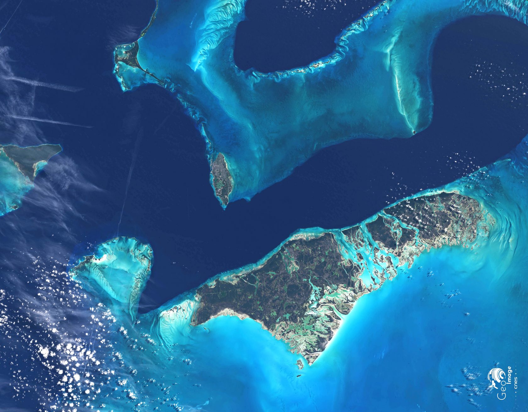
Satellite imagery (to detect the presence of shoals, rafts and filaments of floating Sargassum) is an essential tool to help understand their proliferation, origin and seasonality; to improve forecasts and the analysis of monitoring bulletins and thus help local communities anticipate the next influx of these brown tides.
The SAT-AVISO Data Center offers 2 new products to the ODATIS catalog for the detection of Sargassum algae in the tropical Atlantic, from the OLCI sensors of the Sentinel-3A & 3B heliosynchronous satellites and the ABI sensor on the GOES-16 geostationary satellite . These datasets are offered in deferred time (year 2019) and in real time since March 2022.
Use of the “MAP” tool in the ODATIS catalog allowing the visualization of the NFAI index of the product detection of sargassum banks from Sentinel-3 on the Atlantic; with animation on several daily dates between July 04 and 12, 2019. ODATIS credits for the animation; DOI for dataset 10.24400/527896/a01-2022.007
- This dataset, managed by the CDS -SAT-AVISO of the ODATIS cluster, was produced by CLS and Hygeos (GOES-16) and the European e-shape project (Sentinel-3), with the support of CNES .
- Find out more on the AVISO+ website: Sargassum detection products
2020 – Sargassum surprises Vendée Globe yacht race skippers
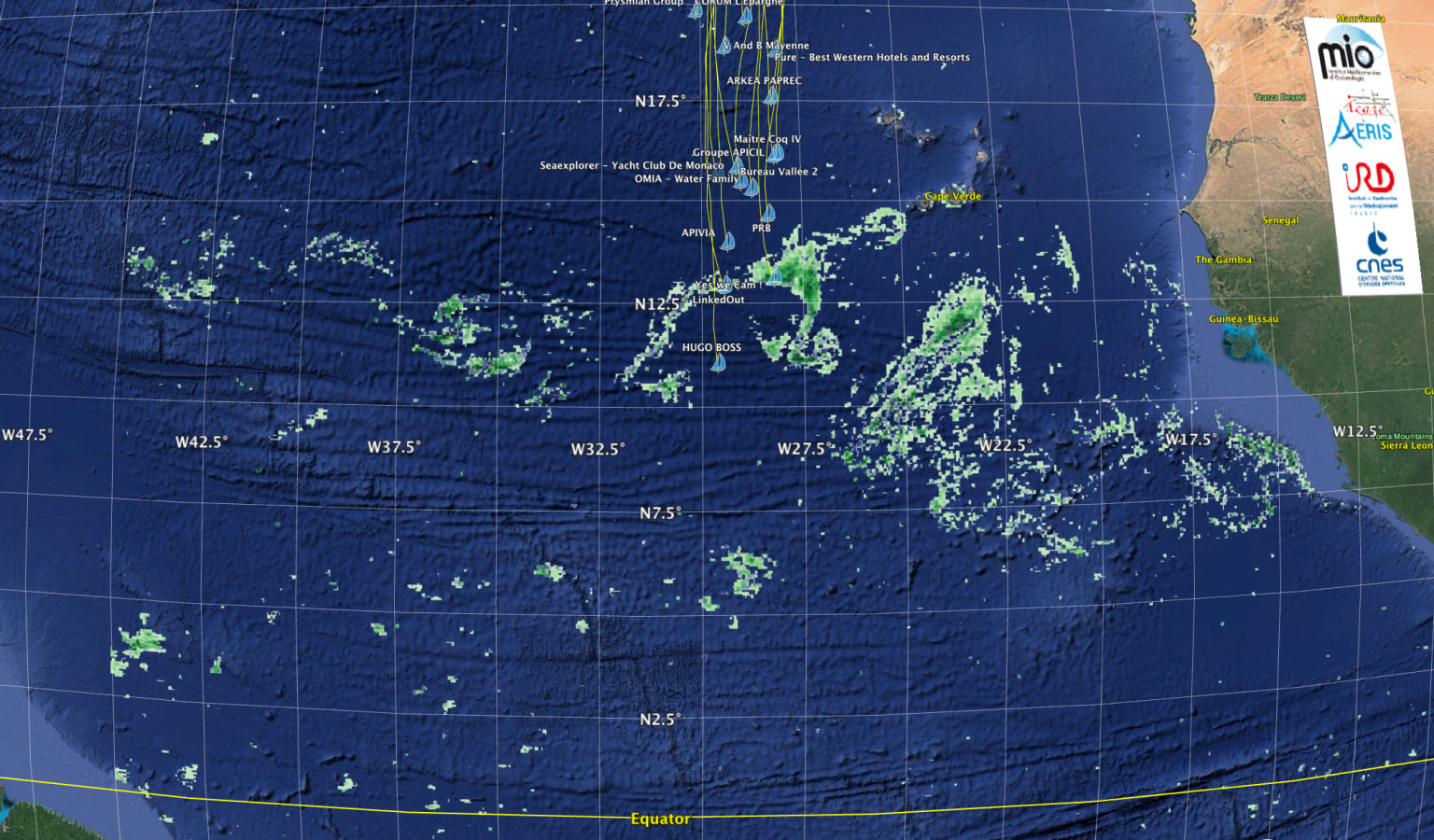
Mid-November during the 2020 Vendée Globe round-the-world yacht race, as the competitors were heading south they were taken by surprise by large amounts of sargassum off Cape Verde, not a zone where the seaweed is usually encountered. The seaweed can foul the protruding parts of a yacht—keel, foils, rudder blades, hydrogenerator, etc.—thus reducing its speed and sometimes forcing skippers to manoeuvre their boat to avoid it or turn around.
Maps from the SAREDA project (SArgassum Evolving Distribution in the Atlantic), led by French space agency CNES and the IRD development research institute, were provided to skippers to help them steer north.

Sargassum occurrence map showing boats competing in the Vendée Globe sailing south off Cape Verde on 16 November 2020 © Jacques Descloitres (AERIS/ICARE), Léo Berline (MIO).
At coastal scale, automatically monitoring these floating algae in targeted zones makes it possible to estimate their drift and where they are likely to wash ashore. Seaweed patches are detected in satellite imagery acquired daily and dedicated bulletins provided to government services, local authority agents and private seaweed collectors.
At the scale of the Atlantic basin, satellite detection establishes seasonal and interannual fluctuations of biomass in the open sea. For the SAREDA project, the MIO joined forces with the AERIS hub and its ICARE data and services centre specialized in analysing satellite Earth remote-sensing data on a massive scale. Together, they generate daily and monthly maps of sargassum in the Gulf of Mexico, the Caribbean Sea and the Atlantic Ocean. This project aims to produce a comprehensive record of these algae’s biomasses from the data archive [2000-2020] of the MODIS instrument on board NASA’s Terra and Aqua satellites. Operational production in near-real time (T+6 hrs) is also planned with a transition underway to the Space Weather Centre at the national weather service Meteo-France.
The distributed infrastructure sharing data and services between the data hubs covers the full data cycle from access to use. The ODATIS ocean data hub will take over responsibility from the AERIS/ICARE data hub for management and distribution of datasets, as well as sharing, back-up and cross-cutting applications.
Sargassum continues to be observed in partnership with ICARE for the FORESEA project (2020-2022) funded by the French national research agency ANR, the Guadeloupe regional council and the Martinique regional authority.
Multiscale coordination
Backed by its institutional partners*, the Data Terra research infrastructure is coordinating other infrastructures involved in generating and distributing data from the SAREDA project. With its AERIS and ODATIS data hubs, working closely with the MIO, it is pooling resources and expertise, coordinating partners and innovating in the field of data processing to support multidisciplinary scientific approaches.
* Ministry of Higher Education, Research and Innovation, CNRS, CNES, Ifremer, IGN, IRD, INRAE, Meteo-France
___________________________________________________________________
Other scientific initiatives investigating sargassum:
– The University of South Florida is producing daily maps to track sargassum, notably in the Caribbean and West Indies, but also in the Atlantic basin
– The Mediterranean Institute of Oceanology (MIO) and IRD have conducted several expeditions in the Sargasso Sea
– The French geological survey BRGM, in partnership with the French environment and energy agency ADEME and the Environment, Planning and Housing agencies (DEAL) in Guadeloupe and Martinique, has developed coastal observation tools using an autonomous camera
– In 2018, the Ministry for the Ecological Transition launched the first national sargassum prevention and eradication plans with ADEME, the regional authorities of Guadeloupe, Martinique and French Guiana, and other neighbouring countries (Brazil, Mexico)
– the ECO3SAR project led by the BOREA aquatic organism and ecosystem biology laboratory in collaboration with researchers from the Université des Antilles, in partnership with the Drôme departmental council’s analysis laboratory, aims to explore avenues for exploiting sargassum seaweed
– The Martinique office of Ifremer, the French institute of marine research and exploration, is taking part in the Save-C project to identify communities of organisms associated with sargassum mats, to study the ecological impacts of massive washing ashore of seaweed and to find technical solutions for harvesting and exploiting it.
_____________________________________________________________________________________________________________________________________


